CD&M - Worthington Bypass - 1923
When the Columbus Delaware & Marion Railway Co. was formed in the early
1900's it took a rather convoluted path between central city Columbus and
the start of its private right-of-way just north of Worthington.
From the interurban loop in Columbus it headed north on Third Avenue,
turned east on Chestnut Street for one block, north on Fourth Street where
it crossed the multiple tracks leading into the Columbus Union Station,
turned west on Warren St. for two blocks, north on Summit Street, west on
Hudson Street for one block, north on Indianola for one block, west on
Arcadia Avenue and finally north on High Street. All of this
was street running until it reached that private right-of-way.
By the early 1920's heavy automobile traffic and the eastbound hill on
Arcadia Avenue slowed the schedule making the Columbus-Marion run longer
than it should be. Also pulling four car freight trains up Arcadia
Avenue often required doubling the hill, a time consuming operation.
The solution to the problem was to build the Worthington bypass which
eliminated Arcadia Avenue and North High Street from the route.
The bypass started at the Indianola Ave point of the route, described
above, where the
CD&M entered private right-of-way just north of Glenn Echo Ravine
generally following the Big Four/PRR Sandusky Branch to just north of SR 161
where it turned west taking it back to the original right-of-way
north of Worthington at Worthington Galena Road.
The following photos were taken in 1923 during the bypass
construction. The Photos are from the DAK and DB collections.
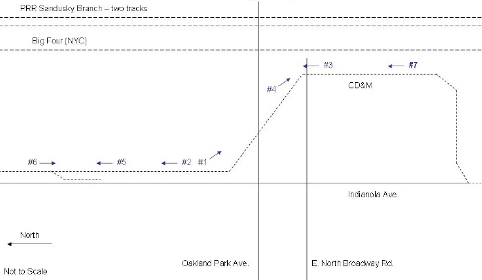
Map of the southern end of the Worthington bypass showing the
camera locations and direction for the next seven photos. The new
private right-of-way was about 6.5 miles long. The map shows the
southern third of the new route. The track came off Indianola Ave
and turned east along the northern edge of Glen Echo
ravine. It then turned north along the Big Four/PRR tracks until E.
North Broadway where it took a sweeping 'S' curve to run along side
Indianola Ave. Further North it would turn east back to the west
side of
the Big Four/PRR tracks again. About 1/2 mile north of SR 161 in
Worthington it turned west for about one mile where it joined the original
CD&M route near N. High Street and Worthington Galena Road.
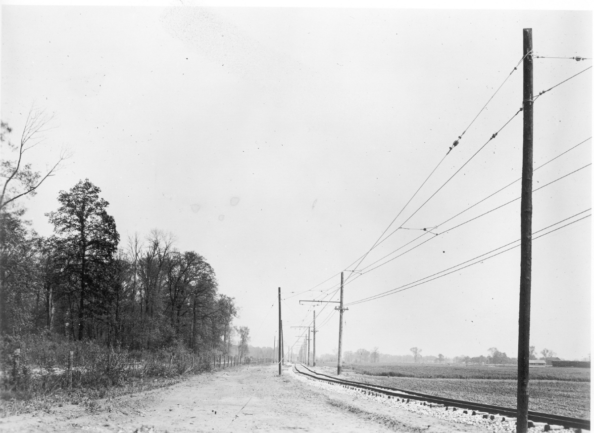
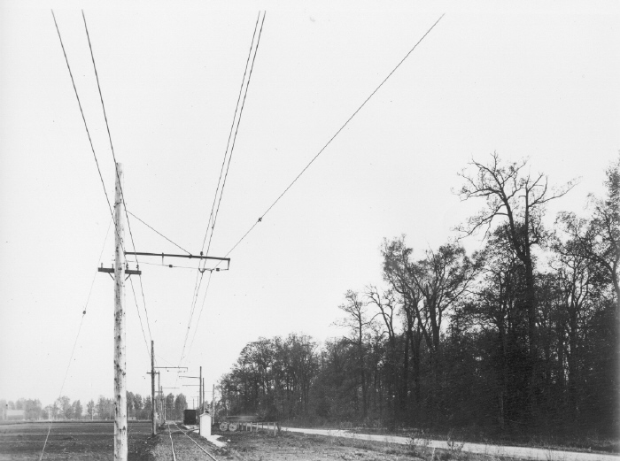
By-pass photo #7
Photo #7 Taken about 1/2 mile south of East North Broadway Road
looking north. The Big Four (NYC) and PRR Sandusky Branch are on the
right. The overhead used catenary construction for hanging the
trolley wire allowing the interurbans to travel at high speeds.
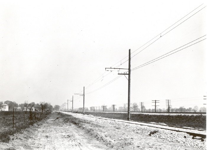
By-pass photo #3
For photo #3 the camera is again pointed north showing the start of the
'S' curve that will take the route closer to Indianola Avenue again.
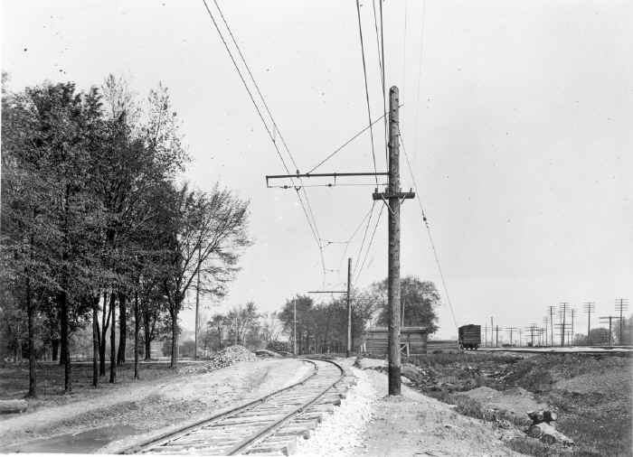
By-pass photos #4
The photographer has walked north about 100 yards and is now shooting
back south. The same lumber pile as was shown in the last photo is
visible on the left of the track.
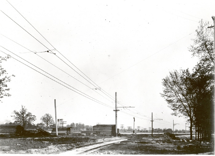
By-pass photo #2
The CD&M curve at Oakland Park and Indianola Avenues looking southeast.
The white house at the very right of the photo is facing Oakland Park
Avenue.

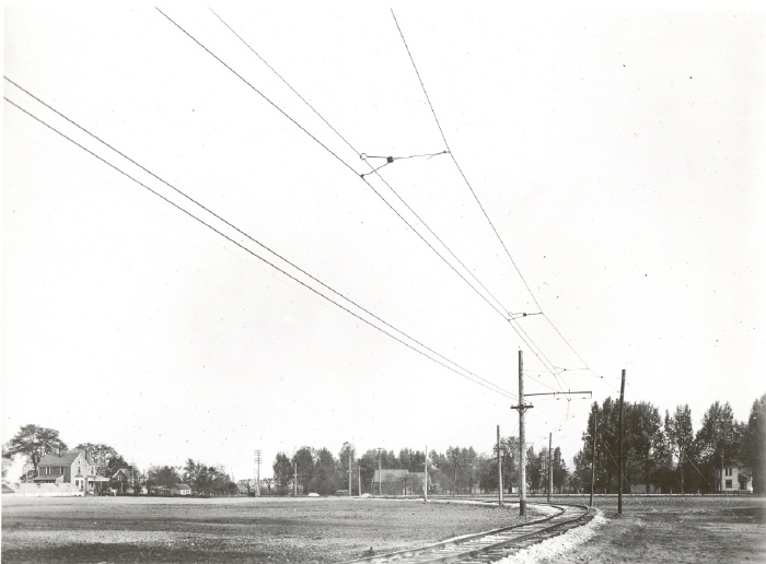
By-pass photo #1
The photographer has turned 180 degrees and shot this photo from the same
spot as photo #2 above. The camera is now looking north and
Indianola Avenue is on the left.
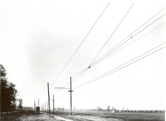
By-pass photo #5
The photographer has moved north 400-500 feet and his camera is still
facing
north. The
CD&M is along Indianola Avenue north of Oakland Park Avenue. A
CD&M passing siding is on the left and a Big Four string of coal
cars with one box car is on the right. The coal cars are labeled C.C.C.&St.L.
By-pass photo #6
The camera is looking south back at the same passing siding.
Indianola Avenue is now on the right. In the distance the track is
curving to the left as seen in photo #2.