Home ← Milestones ← 0Standard Time

Click to enlarge.
The 1883 time zone map issued by Crum's Atlas showing the new Standard Time Zones.
Standard Time Zones
by Larry Brennan, 2021
Railfans and historians are aware of this major contribution of railroads to American life, but most are not. On this day, November 18, 1883, the railroads of the United States and Canada adopted Standard Time for the operation of their trains. Prior to noon on that date, local time was determined by the Sun, but noon occurred in Boston seven minutes before Hartford, twelve minutes before New York, and twenty-four minutes before Washington. In stage coach days, the differences hardly mattered, as journeys between these places might take more than a day, but railroads reduced those journeys to hours, and the differences in times could affect safe operation and inconvenience travelers. The picture of trainmen comparing watches was not merely a picturesque habit or quaint meme; it was vital to safety.Railroads needed a standard time to run by, and usually adopted the time of the headquarters city. If you lived in that city, the clock in the depot was your guide, but if you were at any other place, the local time might differ by a significant amount from the time on the railroad schedule. Books of tables giving local times in various cities were published.
Railroad officials met to discuss establishing a standard time, as had been done by the railroads of Britain in 1847, adopting Greenwich Time as their standard. A single time zone works in Britain, but the US and Canada stretched over 80 degrees of Longitude (excluding Alaska) and since each hour represents fifteen degrees, five zones would be needed. In 1869, rails bridged the continent, and more soon followed. San Francisco was three hours fourteen minutes behind New York. Something had to be done.
After several proposals, five time zones were set, based on the Greenwich meridian. The date of adoption was set for noon, Sunday November 18, 1883. Trains would stop where they were, if ahead of the new time, waiting for noon.
The fifth time zone was named Intercolonial for the railroad that dominated the Maritime provinces in eastern Canada, but that road preferred to use Eastern Time to remain in synch with Quebec. (Later the area did adopt the new time zone, now named Atlantic.) The Time Zone boundaries were drawn for the convenience of the railroads. Breaks occurred where one line met another, or in remote areas that would not inconvenience anyone. All of Georgia and Florida were in Central Time; the break between Mountain and Pacific occurred at Ogden, Utah Territory, where the Union Pacific from the east interchanged with the Central Pacific. Since then, the boundary between Eastern and Central has shifted westward, almost to Chicago.
It wasn't until 1917 that the Federal government took control of setting the zone boundaries and instituting such nuisances as Daylight Saving.
Still -- Imagine all Florida on Central Daylight-Saving Time!
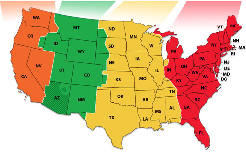
Click to enlarge
The 2021 time zone map.Postings from the Pre-1895 Railroads & Steam Engines Facebook Group discusion:
Post 1 - Quite right. Studying history before that adoption often leaves questions about "what time was it?". For example, during Civil War Battles. Many areas had their own time.
Post 2 - Interesting that part of Maine and the Gaspe region of Quebec are shown as Intercolonial Time. Today's Atlantic Standard Time has a boundary at the US border, and all of Quebec is on Eastern Time, even though the easternmost portion of the Gaspe is further east than the furthest east point of New Brunswick, which is on Atlantic Time.
Post by Larry Brennan, author - This reflects that the original intent of the time zones still rules - to make them convenient and not based strictly on legal or geographic boundaries. When Time Zones were originally proposed, the boundaries were to be halfway between the standard 15 degree meridians - thus 82 degrees 30 minutes between Eastern (based on 75 degrees) and Central (90 degrees). This would cause unnecessary confusion in any place on the halfway meridian. The genius of the plan worked out by the Railroad Time Committee was dividing at places where different railroads met or in remote areas where few people lived. Nowadays commercial or community interests may determine the boundaries. The people of Quebec obviously consider it advantageous to use the same time. The counties of Indiana that are suburbs of Chicago are better suited to Central time. Politicians now redraw the boundaries. Part of Malheur County, in southeastern Oregon, uses Mountain time because the commercial activity of that remote area is centered on Boise, Idaho, although most of Oregon is in the Pacific Time Zone. This leads to the odd situation that there is only one hour difference between Panama City, Florida, on the Gulf coast, and Ontario, Oregon, on the Snake River!